
The Cost of Manual Annotation in Satellite Segmentation
Rapidly and accurately mapping burn scars is critical for disaster response, ecological restoration, and future wildfire mitigation. Although satellite imagery for wildfire monitoring is abundantly available (e.g., NASA, USGS), high-quality segmentation labels are scarce, expensive to create, and inconsistent across annotators. Manual delineation of burn regions is labor-intensive and does not scale to the frequency and geographic spread of wildfire events. This bottleneck motivated our work: building a burn-scar segmentation system that learns faster, requires less human labeling, and remains reliable across geographies.
Human-in-the-Loop Burn Scar Segmentation Using U-Net
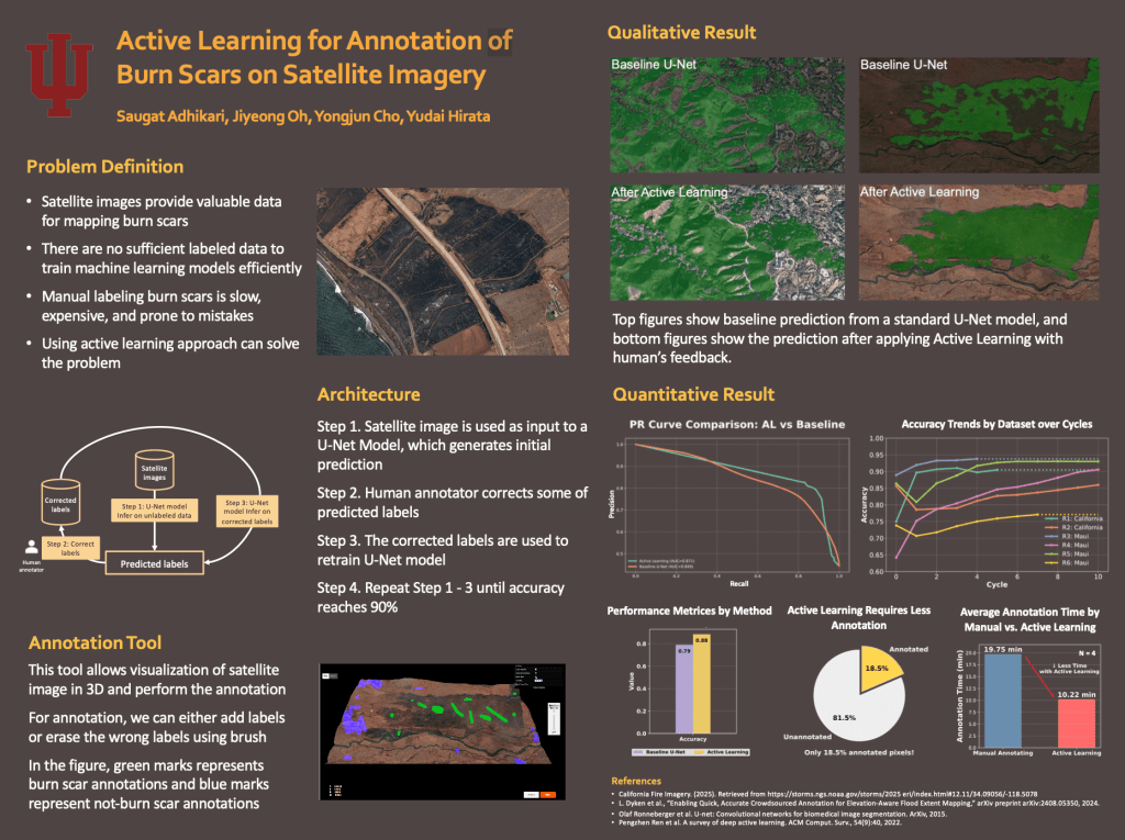
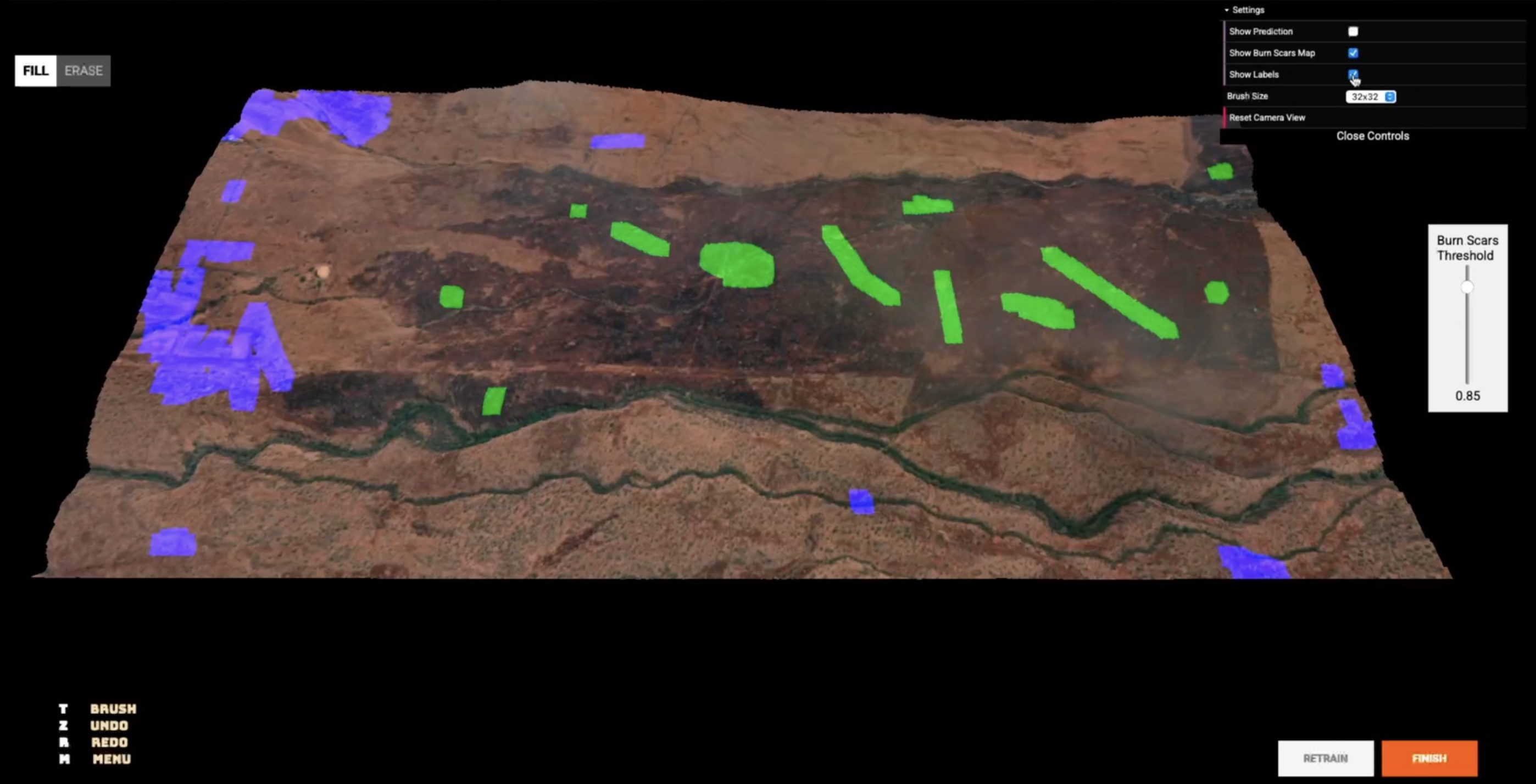
To address this, we implemented a U-Net–based burn scar segmentation model augmented with an active learning framework, allowing the system to selectively request labels for the most informative samples. Instead of labeling large datasets upfront, the model iteratively identified uncertain regions, incorporated human feedback, and updated itself with targeted supervision. We also built a lightweight annotation tool to streamline review cycles and improve labeling precision without increasing workload.
The active learning strategy ultimately reduced manual annotation efforts by approximately 50%, while steadily improving segmentation performance. The model demonstrated strong generalization across different wildfire regions and showed fewer false positives in visually ambiguous areas such as water bodies and shadows. This validated that targeted, uncertainty-driven labeling can replace exhaustive manual annotation, offering a more scalable and reliable approach to rapid burn scar mapping in satellite imagery.
Explore More Works and Projects!
